I cannot understand why anyone thinks that they look realistic.
Enough degrees of freedom can make (almost) any representation work.
Ptolemaic epicycles were as accurate as Keplerian ellipses.
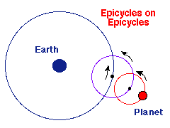
However... what's natural?
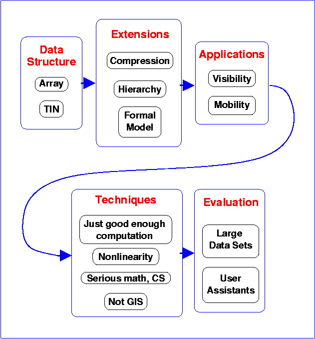
I present an interesting an application area that needs new math.
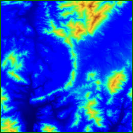
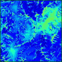
Terrain means elevation. Ignore surface features for now.
Use a grid (matrix) of elevations (in this talk).
Not differentiable many times.
Maybe not continuous (cliffs).
Long range correlations (river basins).
Scale variance (rock has finite strength).
Different regions have different statistics...
Many local maxima; few local minima (above sea level). They become lakes.
Nevertheless, 2D sampled data set will have local minima.
Earth vs moon terrain.
Fourier series
Fractals
Fourier series are good for representing electrical signals because the physics matches the math.
Truncating a series representing a signal produces another legal signal, the low-pass filter of the original.
Truncating a Fourier series representing terrain produces something that is not real terrain.
Too continuous
Too many local minina
I cannot understand why anyone thinks that they look realistic.
Enough degrees of freedom can make (almost) any representation work.
Ptolemaic epicycles were as accurate as Keplerian ellipses.
However... what's natural?
We could formally ask about best algorithms for
compression,
visibility
Nonlinear
The formative agent (on earth) is water erosion.
Also uplift, downcut, etc.
We do lose the ability to form a linear combo of a set of basis
functions.
There may be several correlated layers of data for the same surface.
E.g.: elevation and slope.
Q: Why store slope explicitly?
A: Computation on demand is error-prone.
If each layer is compressed separately, they become inconsistent.
That's worse than being inaccurate.
These are from a commercial mapping product.
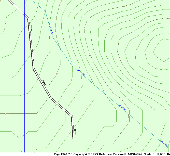
Users of commercial GIS packages think that these problems
are natural.
aka data fusion
The same data may be available from different sources,
... at different resolutions, with varying accuracies.
E.g., elevations from...
Combine them, to create one layer, plus error bars.
The proper data representation can make difficult problems vanish.
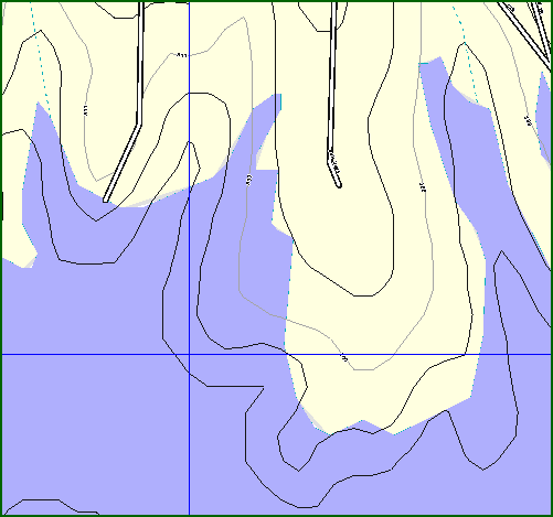
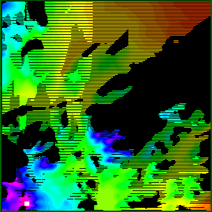
E.g., we want to interpolate contour lines thru some data.
The obvious method is to trace each contour line thru the grid cells, independently of its neighbors.
However, the distance between the lines is not smooth. The lines might even cross.
Solution: Interpolate a surface from the data. Then trace the contour lines on it.
RMSE too simplistic.
Rather: effect of errors on derived properties, such as visibility.
How much can each possible observer see?
| 
|
Assume two points on the moon's surface want to communicate.
No ionosphere to reflect radio.
No stable satellite orbits.
Obvious solutions:
Fiber, or
Relay towers
What, specifically, can a particular observer see?
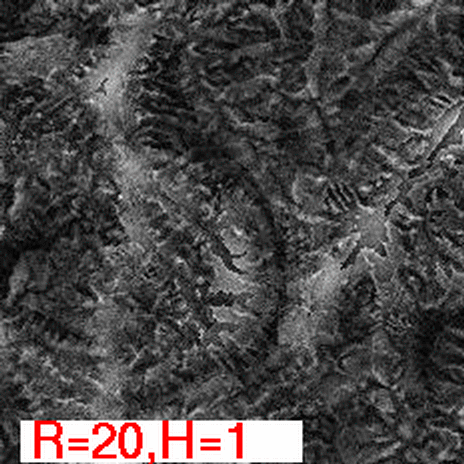
Small changes in the input cause large changes in the input.
The previous beautiful image is partly (mostly?) fiction.
However certain regions are definitely hidden, and others are definitely visible.
Find them.
Note the nonlinearity: visibility is a step function.
If...
The input elevations are noisy, and
The output visibilities are very sensitive to the input,
Then...
A much quicker, less accurate, computation might produce just as good output.
A serious quantitative speed increase will translate into a qualitative improvement in what can be done.
Red side places observers to cover as much terrain as possible.
Blue side, knowing the red observers, finds areas guaranteed to be hidden.
Visibility is multidimensional:
Observer height, target height, radius of interest, number of test samples used, ...
How visibility index depends on height:
Can the function be simplified?