I present an experimental study of a new algorithm that synthesizes separate programs, for fast viewshed, and for fast approximate visibility index determination, into a working testbed for quickly siting multiple observers jointly to cover terrain from a full level-1 DEM.
xxaaaaaaaaaaaaaaaaaaaaaaaaaa bbbbbbbbbbbbbbbbbbbbbxaaaaaaaaaaaaaaaaaaaaaaaaaa bbbbbbbbbbbbbbbbbbbbb
aaaaaaaaaaaaaaaaaaaaaaaaaa bbbbbbbbbbbbbbbbbbbbb
aaaaaaaaaaaaaaaaaaaaaaaaaa bbbbbbbbbbbbbbbbbbbbb
aaaaaaaaaaaaaaaaaaaaaaaaaa cbbbbbbbbbbbbbbbbbbbbb
aaaaaaaaaaaaaaaaaaaaaaaaaa bbbbbbbbbbbbbbbbbbbbb c
aaaaaaaaaaaaaaaa bbbbbbbbbbbbbbbbbbbbb
aaaaaaaaaaaaaaaaaaaaaaaaaa bbbbbbbbbbbbb
aaaaaaaaaaaaaaaaaaaaaaaaaa bbbbbbbbbbbbbbbbbbbbb
aaaaaaaaaaaaaaaaaaaaaaaaaa bbbbbbbbbbbbbbbbbbbbb
aaaaaaaaaaaaaaaaaaaaaaaaaa bbbbbbbbbbbbbbbbbbbbb
Context
Several year project in studying terrain elevations. Previous results:
- Triangulated Irregular Network I can TIN all points of a level-1 DEM in about a minute on this laptop.
- Triangulated compression Triangulated compression Triangulated compression Triangulated compression Triangulated compression Triangulated compression
of can TIN all points of a - Lossless and lossy compression of gridded elevation databases.
- Interpolation from contours to grid.
- Observer Siting
PhDs generated:
-
Clark K. Ray, Representing Visibility for Siting Problems, 1994. (now at US Military Academy, West Point)
-
Michael B Gousie, Contours to Digital Elevation Models: Grid-based Surface Reconstruction Methods, 1998. (Wheaton College)
Helio Pedrini, An Adaptive Method for Terrain Surface Approximation Based on Triangular Meshes , 2000. (Universidade Federale do Paraná)
| 
|
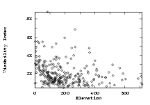
| Elevation vs visibility | Lossy compression |